Small Unmanned Aircraft Systems (sUAS or drones) have opened a world of possibilities by giving people a bird’s eye view of remote and difficult-to-access areas—however, the benefits of this technology span beyond a simple picture from above. For the railway industry, drone aerial inspections provide a way to collect accurate data faster and safer.
A Better Alternative to Manual Railway Inspections
Traditional, boots-on-the-ground railroad assessments and inspections can be complicated and require a lot of coordination to ensure the safety of all those involved. Traditional visual inspections also require track time, which takes time away from maintenance crews and can delay train schedules across the network. Many railway inspections are also in areas where roads do not exist and can require inspectors to travel indirect routes, which are inefficient and time-consuming.
Drone technology removes these and other common barriers to site access, allowing engineers to gather information with minimal disruption to railway maintenance and operations.
Railway sUAS Inspection Improves Data Collection and Analysis
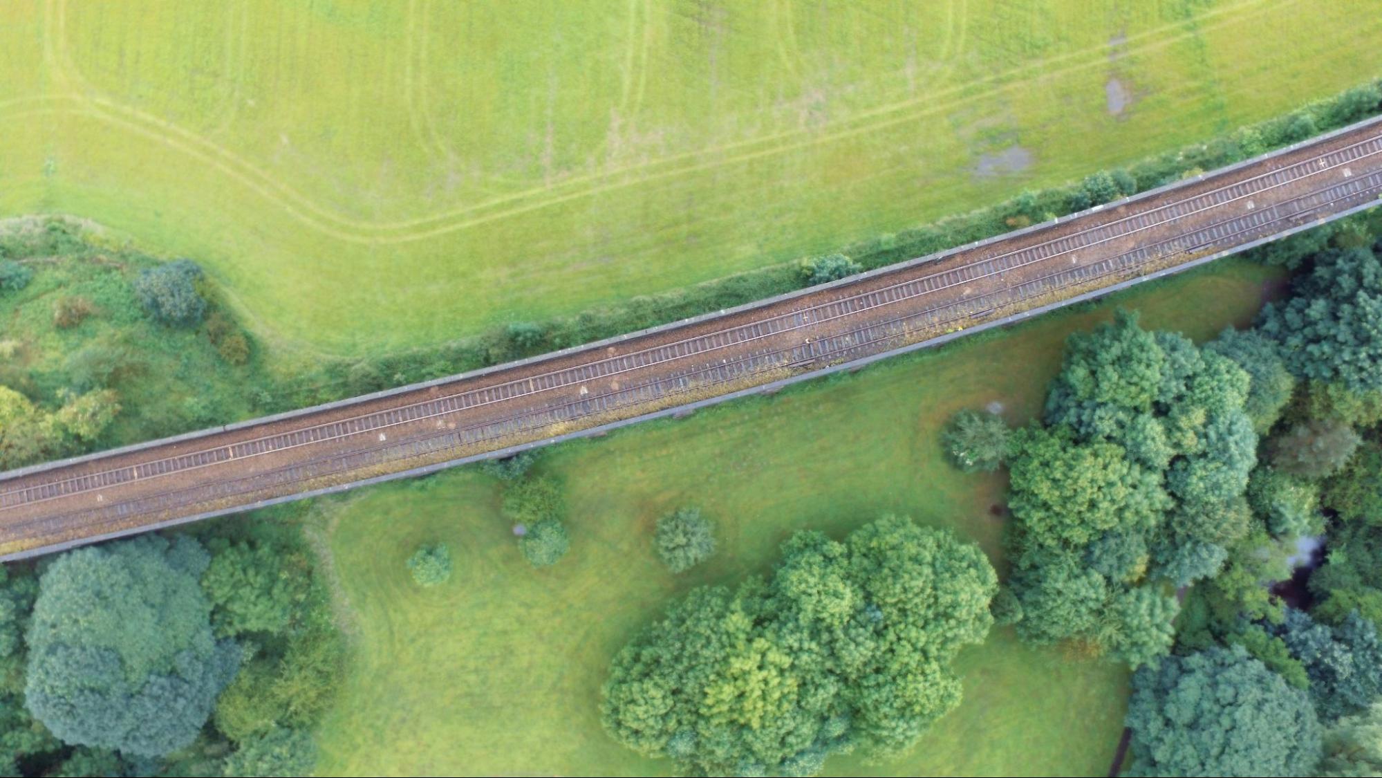
Drones have become invaluable in assessing infrastructure and addressing issues like damaged structures, plugged culverts, and vegetation overgrowth along railway tracks. When railroad-related emergencies occur, the quick deployment of drones allows responders to quickly and safely assess the situation.
Engineers always seek ways to gather as much data as possible to help them make informed decisions. Let’s look at some of the technologies they leverage to perform drone railway inspections:
- Topographic mapping: LiDAR data collected using drones provides accurate results and is safer and more efficient than traditional methods in most situations.
- Inspecting tracks, bridges, and tunnels: Enhancements in camera resolution and optical zoom capabilities have taken a bird’s eye view and refined it into an eagle’s eye view. This gives engineers the tools to gather the finest details of critical infrastructure from a safe distance.
- Thermal imaging inspections: Critical infrastructure issues are not always visible to the naked eye. Thermal imaging cameras attached to drones can utilize heat signatures related to material integrity, energy loss, or hidden damage within the infrastructure.
- Emergency response efforts: Initial assessments are critical for the safety of the responders and the surrounding community. Pinnacle’s ability to rapidly deploy drones to gather the initial data is crucial in response efforts. Air quality monitoring equipment and specialty cameras that attach to drones are other tools used to conduct site assessments from a safe distance.
- Stormwater and vegetation assessments: Stormwater infrastructure is often located in hard-to-access areas. Drones can be used to identify issues and gather data of the surrounding areas to aid in developing engineered solutions. Vegetation growth and health also play crucial roles in stormwater management. Multispectral cameras are a key tool that can be attached to drones to help experts assess and resolve the problem.
Data collected by drones still relies heavily on the human expertise of engineers and other experts. But when used together, human expertise and drone railway inspection technology improve crew accuracy, safety, and efficiency with less environmental impact.
Drone Inspections: A Safe and Sustainable Solution
Extensive drone training is required to ensure safe flight operations. Depending on the type of data collected and how it is collected, varying levels of skill and experience are required to ensure safe and effective flight operations. Before each flight, Pinnacle reviews the task at hand to guarantee they have the right people and equipment for the job.
Compliance with drone regulations is also a crucial part of each flight. The FAA regulates drone flight operations; however, other state and local regulations can govern in certain situations. Although the regulations apply to everyone, the FAA holds commercial drone pilots to a much higher standard than hobbyist drone pilots. Airspace restrictions can change fast, especially in emergency situations. The Professionals at Pinnacle have navigated through these situations numerous times to provide clients with quality data that is collected in a safe and timely manner.
In most situations, sUAS railway inspections can provide a much more sustainable solution than traditional methods. Traditional methods often require heavy equipment and require teams of people to complete the operation. Drones are powered entirely by batteries, emitting zero emissions during flight operations. They also provide a non-contact solution for railway assessments in environmentally sensitive areas.
The Future of Drone Railway Inspections
What does the future hold for drones in the sUAS railway inspection industry? Drone technology constantly evolves, and with that comes the introduction of better, faster, and more accurate technology. Artificial intelligence (AI) is another emerging trend that continues to evolve and improve the tools engineers utilize to analyze data and make critical decisions. Engineers currently use AI in drones and drone-related software to speed up site assessments by identifying locations of predetermined site features, with the ability to monitor these locations over time.
As we move forward, the technology used for drone aerial inspections will only continue to improve the speed and accuracy of railway assessments and data collection.