Railway Siding Expansion Site Inspection
The railroad industry faces a unique set of challenges due to remote locations and rugged landscapes. Thorough assessments help determine the feasibility of rail projects and are critical in identifying construction challenges ahead and potential safety hazards.
With expertise in rail regulations and the environmental challenges faced by the industry, Pinnacle Engineering helps clients identify risks and find innovative ways to overcome potential roadblocks in their projects. Our solutions combine the latest technology and the knowledge of a team experienced in engineering, risk mitigation, and emergency response.
Environmental Challenge
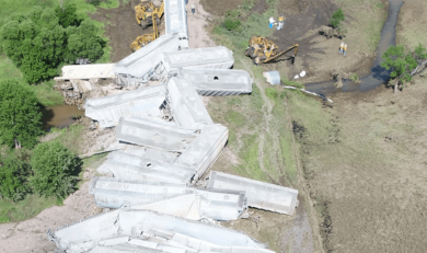
A railway client was planning to extend a section of siding on a route running along the Mississippi River. They needed to conduct an environmental inspection before adding the extension and contacted Pinnacle Engineering for assistance. Much of the land surrounding the track was heavily forested with 100+ foot bluffs. Though constructing tracks along a river is common, the complex landscape made it difficult and dangerous to use traditional on-the-ground crews to collect the necessary engineering data.
Technology & Engineering Solutions
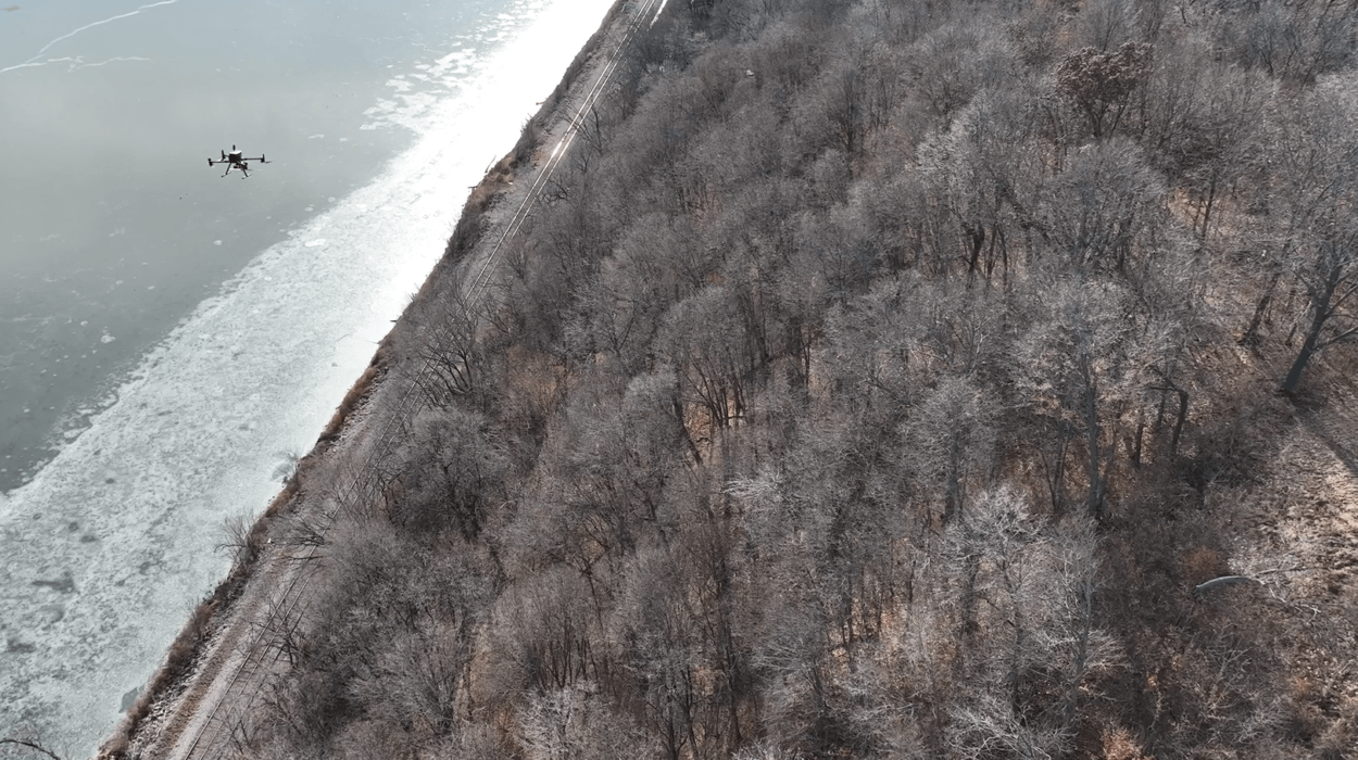
Our engineering team determined that LiDAR drone technology was the best solution for collecting critical data for the extent of the proposed siding extension. The primary benefit of drone-based solutions is the ability to deploy the equipment from a nearby location, eliminating the need to send crews into difficult-to-navigate areas. Additionally, drones that utilize geo-referenced LiDAR technology collect points at a much higher density, providing a more accurate representation of the area.
As a supplement to the LiDAR data, drone-based thermal imaging was collected at various elevations along the bluffs to identify heat irregularities, which could indicate areas of groundwater seepage, unstabilized soil, or weakness in rock formations.
Analysis & Results
The data allowed the creation of detailed topography, which the client used to plan their railroad siding extension successfully without stepping foot on site. Deploying drones was safer, more convenient, and took significantly less time than manual data collection.
In addition to the detailed topography, thermal imaging helped identify rock shelves and natural springs along the bluffs. Over time, water erosion causes instability that can result in the shelves collapsing. Due to the proximity of the bluffs to the planned extension, loose or falling rock poses a significant risk to the railroad infrastructure. The client will likely conduct annual inspections of these areas using LiDAR drones and thermal imaging, using the data initially collected by our team to conduct comparison analyses to identify areas where erosion has worsened or rock shelves have shifted.
Our goal is to continue to build upon our reputation of delivering high-quality services, maintaining open and responsive communications, and providing cost-effective solutions that consistently meet our client’s needs.
Comprehensive Solutions for the Railroad Industry
No challenge is too great when you have a trusted partner guiding you every step of the way. We serve the railroad industry with services that address your needs for compliance, data collection, engineering and permitting, inspection and analysis, and emergency response. Acting as an extension of your team, we support your operations and help you navigate local, state, and federal regulatory requirements for successful results.

Pinnacle’s approach is not like most consultants; they work with our company’s best interests in mind and propose cost and time-effective remedies over remedies that are more financially beneficial to themselves. This has also built a tremendous level of trust that makes working together that much easier.
Environmental Engineer - Oil & Gas Client
Pinnacle is very responsive to requests. They have not missed a deadline on any service thus far. They seem willing to go the extra mile when asked for input on potential projects.
Environmental Manager - Oil & Gas Client
Pinnacle is local and able to respond quickly. In addition to being a subject matter experts, they can take the lead with little input needed from me to do so. Pinnacle is professional, knowledgeable, and customer service oriented. They are dependable and are respected and known within the local regulatory world.
Environmental Response Manager - Oil & Gas Client
Pinnacle is key to our company’s operations in my area of responsibility. Honestly, there is not another professional contractor that works any harder for us than the staff at Pinnacle Eng. If they can’t do it in-house, they know someone that can. They are “Problem Solvers” at the highest level.
Manager, Midwest Operations - Oil & Gas Client
I worked closely with Pinnacle at a previous role and then incorporated their services when I moved companies. I am a huge fan of the company. They are down to earth and incredible to work with. Their portfolio is extensive and the staff they have are all amazing to work with. I am grateful to partner with them in each of my roles.
Environmental Manager - Aerospace Manufacturing
I work with Pinnacle daily over the last few years. The top impression is that they deliver. They follow through and do what they say they are going to do. They are professional and keep us out of trouble.
VP of Engineering & Construction - Renewable Energy Client
Pinnacle is always there for us. Their broad range of expertise from environmental response to environmental permitting to their vast subcontractor network makes them an invaluable resource to our organization. I call them for everything from routine projects to largescale rail-based incidents. I’m thankful to have them as a partner.
Manager of Environmental Remediation - Class I Railroad
Environmental Engineering Solutions for a Better Tomorrow
At Pinnacle Engineering, we understand the importance of collaboration and being responsible stewards of the environment. We act as partners, working closely with you to understand your project, identify potential challenges, and help you determine the best path forward.